The fall of the Western Roman Empire occurred on September 4, 476, when Romulus Augustus, the last Emperor, was deposed by Odoacer. Even then and for a thousand years afterwards, overland trade in France followed the old familiar Roman roads known as the
Voie Romaine (Roman Way).
[Image French National Library, Carte des
voies romaines
du Département de la Haute-Marne 20 Lieues gauloises / Th. Pistollet de
St. Ferjeux del., 1860. Map detail shows the route north from Langres
past Graffigny-Chemin to Soulosse-sur-St-Elpohe. The route continues to Trier.
In Roman Gaul a system of roads was organized in the decades before Christ by Marcus Vipsanius Agrippa around Lugdunum (Lyon). The collection became known as the
Via Agrippa (Road Agrippa) and contained over 21,000 kilometres (13,000 miles) of paved stone roads. One route,
beginning in Lyon, goes north 270 kilometers (170 miles) to
Langres. At Langres it branches. One branch goes northwest to Reims, the
other north and east to Toul, then further north to Trier.
The Roman Way to Toul and passes through the village of Graffigny-Chemin. Indeed, as one drives north through Chemin, the road will be marked as
Voie Romaine.
 |
| heading north on the Voie Romaine, church of St Nicolas de Chemin |
[Images of Graffigny-Chemin downloaded from Google Earth.]
Graffigny-Chemin's location is well-situated as a way station on the route. Then, as now, it lies 60 kilometers north of Langres, capital of the Gallic tribe the Lingones, and a further 70 kilometers north to Toul, capital of the Leuci. (In
Commentaries on the Gallic Wars, Julius Caesar mentions both Lingones and Leucis.)
From Langres to Toul, it is about 125 kilometers (about 80 miles). This would be about 4 days travel for a Roman legion or those who followed in their footsteps: bishops making parochial visits, priests, wandering minstrels, students, tinkers, merchants, beggars, gentlemen, and those on their way to the various fairs of medieval Europe.
The trip to
Graffigny-Chemin is about half that distance, or two days out either
way. Graffigny-Chemin possesses a spring for water (the well for the spring water is still found outside the Church of St.Christophe and St. Elophe) as well as nearby fields where traveling merchants could rest by the roadside for the night while their animals grazed.
 |
| view of the Church of St. Christophe and St. Elophe, Graffigny |
|
|
Only the well-to-do and soldiers rode, everyone else walked. Those who walked would have to put up with the horse droppings, and make way for horse and cart. One imagines that, like in Chaucer's
Canterbury Tales, the commoners known as the
pied "dusty feet" would seek out fellow travelers for companionship. If there were houses in the location where Graffigny and Chemin now stand, it is not hard to imagine that they served as a guesthouse or an inn.
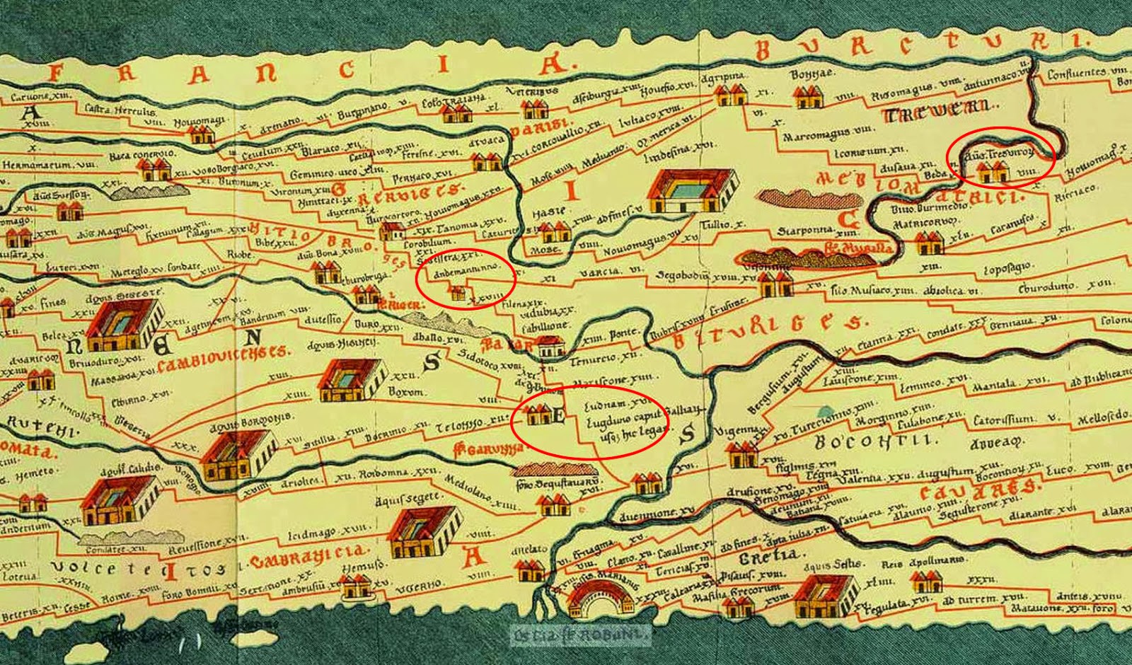
The Peutinger Table was drawn in 1265 by a monk from Colmar, but its information dates back at least to before 79 AD since Pompeii is included. Moreover, Cologne is identified as Agripina, the Roman general who under Octavian, organized the roads in Gaul into a system collectively known as the Via Agippina.
The detail above shows the route from Lyon, capital of Gaul, to Langres, then to Neufchateu (Noviomagnus) and Toul (Tullio). From Toul the route crosses the Moselle River at Dieulouard, Meurthe-et-Moselle (Scarponna) before going on to Trier (Tresviroy).
More info on the map.